


airborne geophysical survey
Airborne surveys measure the earth's magnetic field, resistivity or other electromagnetic properties, or gamma ray emission. These techniques offer low impact aerial survey of the earth in search of certain resources underground. An environmentally friendly and low cost solution compared to other industry options. We work with the best in the business and provide a safe and effective survey with clean data and little to no retracing. Call us now and see how we can help you!
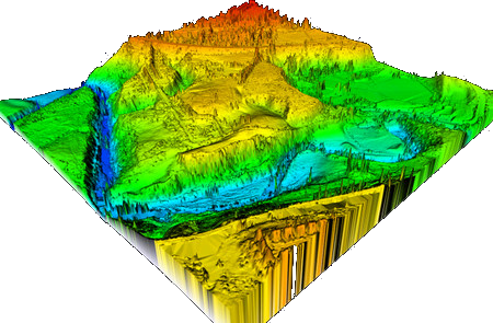
Aerial survey- Gis and lidar mapping
LIDAR, which stands for Light Detection and Ranging, is a remote sensing method that uses light in the form of a pulsed laser to measure ranges (variable distances) to the Earth. These light pulses—combined with other data recorded by the airborne system— generate precise, three-dimensional information about the shape of the Earth and its surface characteristics We work with industry leaders creating a substantial team of experts to give you the highest quality of mapping capabilities. We accept jobs from any sector and no matter the scope of work.